
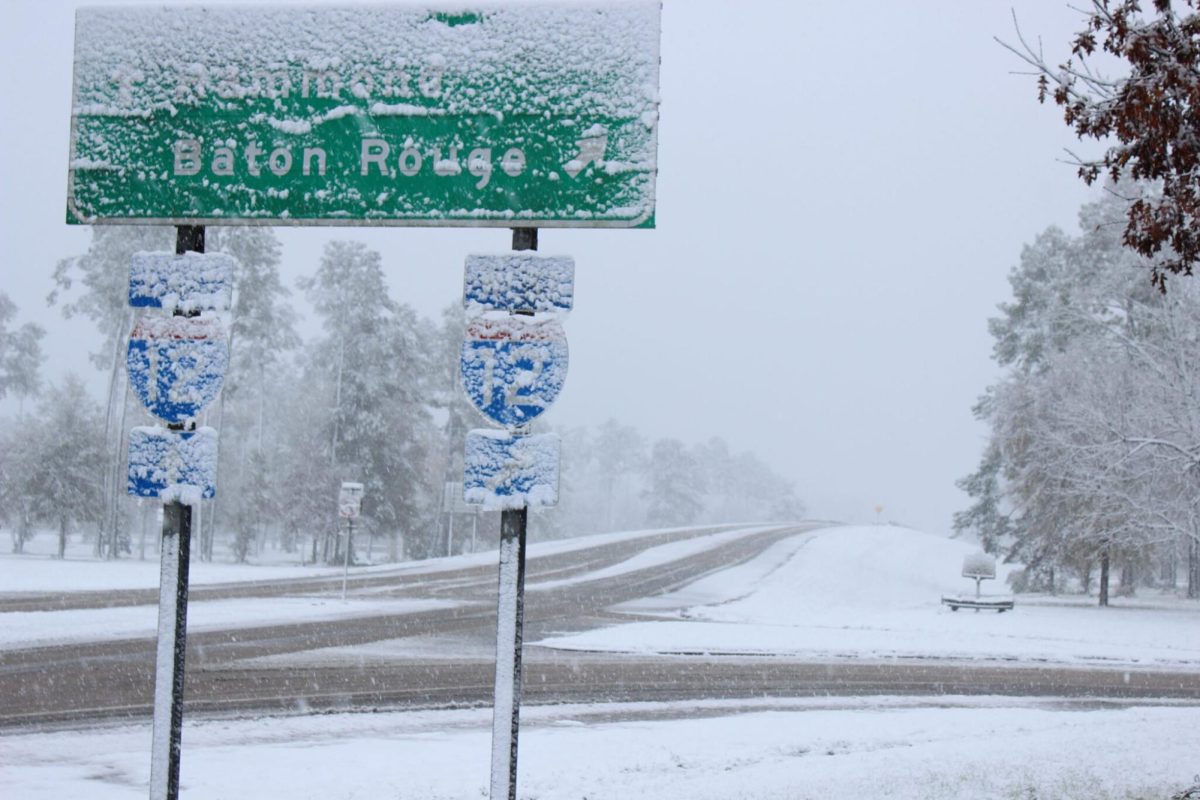
It seems impossible: Despite steadily warming winters, parts of the U.S. have seen an increase in extreme winter weather, reaching as far south as subtropical Louisiana.
At first glance, the studies seem inconsistent. How is it that Louisiana has simultaneously seen a decrease in the number of total freezing days per year, yet our local weather channels report weekend after weekend of freeze warnings? If winters are supposedly getting warmer, how was Thibodaux blanketed in 8.5 inches of snow only a year ago?
The answer lies in a term that appears equally as paradoxical as the data: global warming.
What is Global Warming?
Global warming, as listed by the National Weather Service, is one of climate change’s with many consequences. While the terms are often used interchangeably, global warming refers primarily to the long-term increase in Earth’s temperature, according to NASA.
The effects of global warming can be seen worldwide, such as in the increase in day-to-day temperatures or the prolongation of summer, but they are most observable in the Arctic Region.
As Dr. Barry Keim—former Louisiana state climatologist and current climate professor at LSU Health New Orleans School of Public Health—explains, warming conditions in polar regions causes a “lessened gradient between the polar regions and tropical region.”

How Does Arctic Warming Impact Louisiana?
Polar regions are often characterized by persistent cold, low-pressure jet streams referred to as “polar vortexes” (National Weather Service). These jet streams are usually confined to polar regions, such as the Arctic, but are susceptible to weakening and “stretching” in warmer conditions.
In comes global warming: a threat to the barrier containing Arctic winds.
“When you have a strong gradient, that will encourage the air to stay bottled up in the polar region. But with climate change and the declining gradient—from the pole to the tropics or the tropics to the pole—it makes that jet stream “lazy,” says Keim.
“As a result, the thinking is that that allows the stretching of the polar vortex, which is that jet stream’s location. Climate change allows it to stretch and kind of spill out in various locations, which can then deliver some of that really cold air to places pretty far south.”
How Does Polar Vortex Spillage Impact Louisiana’s Future Winters?
On average, Louisiana’s winters have seen a gradual rise in temperature. Per decade, the state has seen a 0.6 degree Fahrenheit increase . Since 1950, Lafourche has seen a loss of nearly one freezing day every 10 years.

While global warming may be causing Louisiana’s winters to warm on average, at the same time it increases the risk of polar vortex spillage. Winters may be consistently warmer, but they may also deliver more frequent, short-lived extreme conditions as seen in 2025’s record-breaking blizzard and January 2026’s current pattern of freezes.
These extreme winter conditions have the potential to evolve into year-round weather anomalies, such as increasing the risk for intense rainfall.
“Warmer air temperatures evaporate more water off the ocean. When it’s warmer to begin with, they can store more moisture as in vapor; when it’s carrying more vapor and it hits up against a cold front, there’s more moisture there to be wrung out of the atmosphere to make clouds and put more rain on the ground,” states Keim. “It makes us more vulnerable, in theory, to bigger, heavier rainfall events.”
As the Arctic warms and the polar vortex continues to release bursts of cold air, it becomes increasingly likely that extreme winter weather is something that Louisianians will continue to endure for years to come.
Preparing for the upcoming winters requires more than just a coat—it may be a call for a broader discussion of climate change, as well.